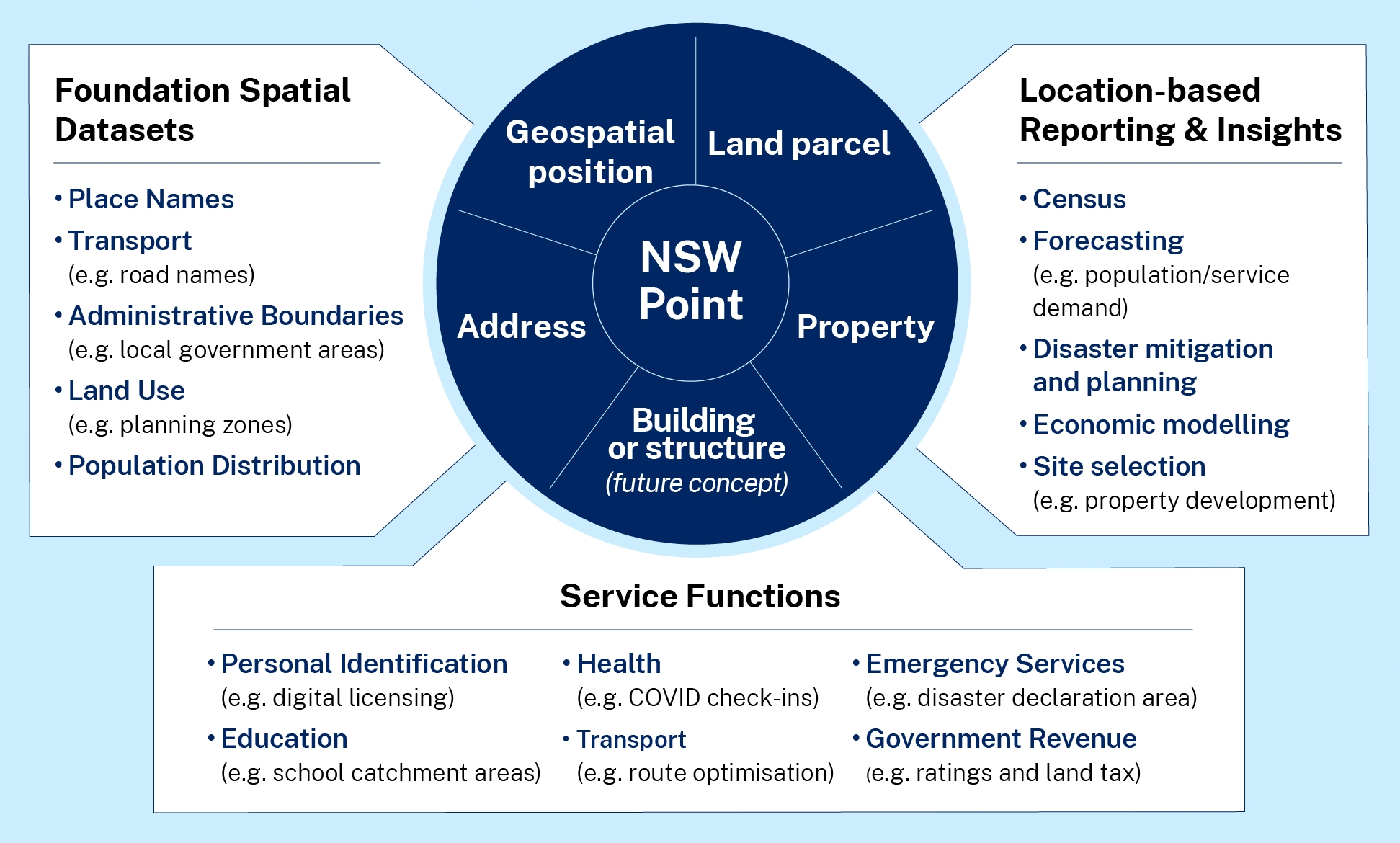
A validated authoritative address is key data, essential for government agencies to efficiently deliver services to the community. NSW Point validates addresses that can be used in a wide range of government application forms and projects.

Beneficial when using applications in the field, the Geocoder API facilitates detailed location information by entering geographic coordinates.

Using a Cadastre Parcel ID validates and retrieves associated address, property, and administrative details. It encompasses lot, strata, and road plans, offering comprehensive land parcel information for specific areas or boundaries.

Property ID is a unique identifier used for land valuation and rating purposes. Once validated, it provides relationships to addresses, cadastral parcels, and administrative boundaries.
What are the Foundation Spatial Data Indexes (FSDI)?

Every day, NSW Government and its partner organisation’s deliver hundreds of services, resulting in thousands of transactions flowing in and out of agency systems. What if we knew where these transactions were happening and could link them to a location to map the results? Imagine how this would enable us to better manage our services. FSDI are the key that can unlock this potential.
The FSDI are simple references that are already used in many government transactions and service requests. They include:
- Address
- Land Parcel
- Property
- Geospatial Position (Coordinate)
These indexes allow customers to apply for and receive essential services, locate places during emergencies and events, and support property and land development. The power of the FSDI is in their relationships to each other, and to other administrative and Foundational Spatial Datasets.
NSW Point provides real-time FSDI validation and data enrichment services to NSW government agencies with benefits that include:
- Cost savings through a single all-of-government purchase contract.
- Spatial enablement of transaction data for location-based reporting.
- Current, reliable, and accurate FSDI information at state or national levels.
- Improved cross-agency communication, data sharing and reduced duplication.
